


To make a quantitative assessment of forest cover in Mongolia and assist in the development of a strengthened local strategic document to manage forest resources.
Produce a high-resolution forest cover map for Mongolia using 30m Landsat data, resolving discrepancies in existing forest cover estimates.
Develop a comprehensive approach for integrating high-accuracy forest data into national and local forest management plans.
Provide policymakers with accurate forest data to support effective decision-making and the development of alternative forest management scenarios.
Generate forest type maps and forest change detection maps to help environmental and forestry organizations assess forest resources and change drivers, supporting informed policy decisions.
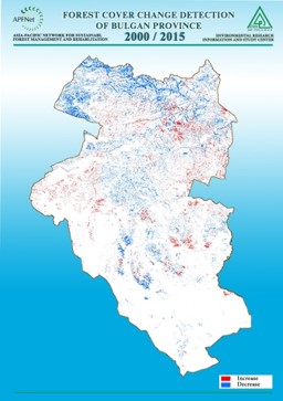
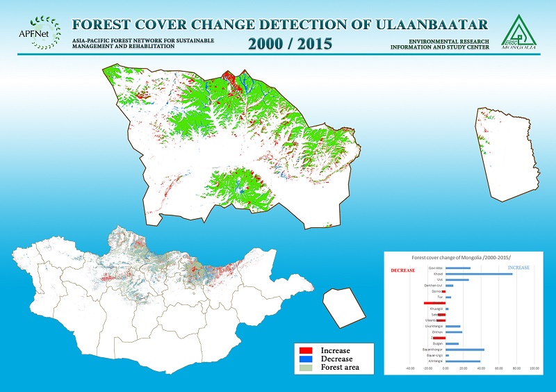
Produce an accurate forest cover map by analyzing Landsat and MODIS data, detecting forest changes from 2000 to 2014, and conducting an accuracy assessment.
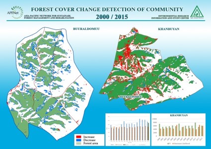
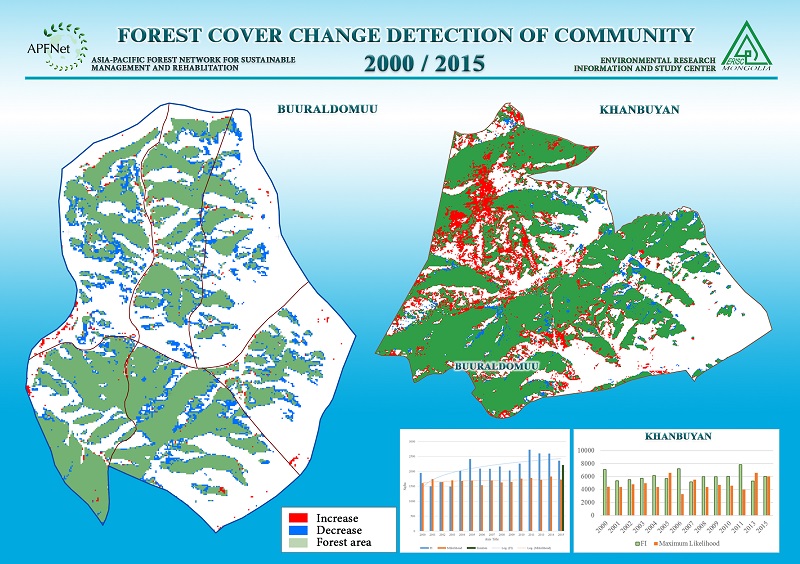
Map forest types in pilot community forest through using high-resolution IKONOS data to classify forest types and verify accuracy.
Develop training sessions and guidelines to help community forest groups integrate mapping techniques into forest management planning.
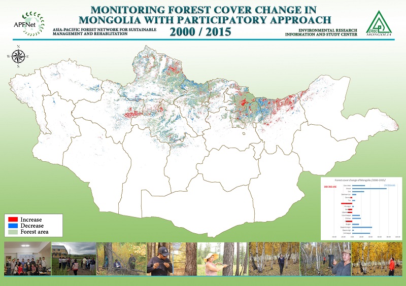
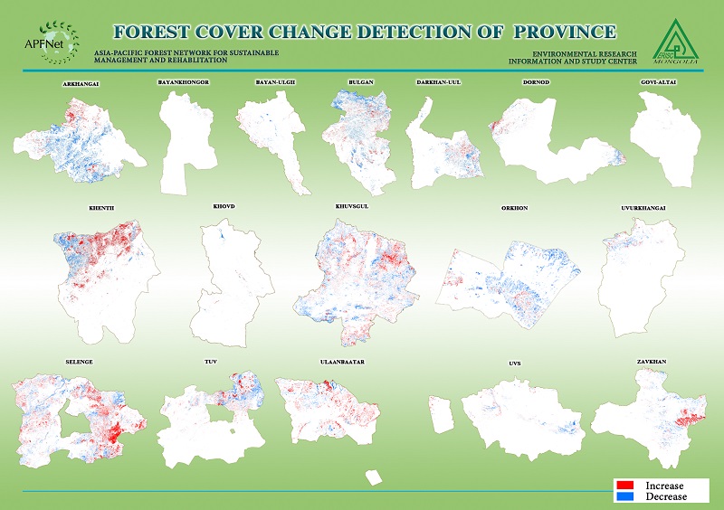
The project successfully mapped and analyzed forest cover changes in Mongolia from 2000 to 2015, providing the first-ever comprehensive forest cover change map for Mongolia. By utilizing Landsat and MODIS satellite data, the project identified trends in forest loss and regeneration, offering critical insights for forest management and policy development. High-resolution satellite imagery was also applied to two pilot community forests, producing detailed forest type maps that support localized forest planning and conservation efforts.
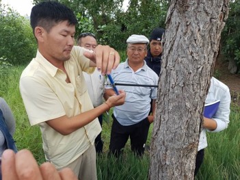
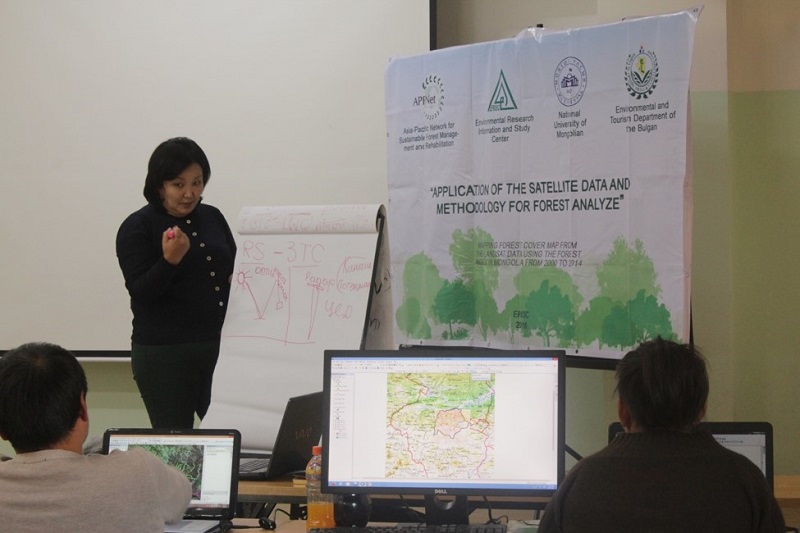
Capacity-building initiatives played a key role in the project’s success, with training programs equipping forestry officials, community members, and researchers with skills in remote sensing, forest monitoring, and GIS mapping. This knowledge transfer enhanced the ability of local stakeholders to independently assess and manage forest resources, contributing to long-term sustainability.
The project’s outputs directly influenced forest policy by providing reliable, high-accuracy data to support decision-making at national and provincial levels. The methodology developed through this initiative offers a scalable model for future forest monitoring and management, ensuring that Mongolia can continue tracking forest changes efficiently.